Mapas de Trenton (Ontario)
 1845|BARBER, John Warner and HOWE (Henry)
 1873
1873
 1872|Gray, Ormando Willis; Walling, H. F.1:300 000
 1873|Hopkins, G.M.1:253 440
 1868|Beers, F. W. (Frederick W.)1:253 440
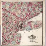 1867|Beers, Frederick W.1:253 440
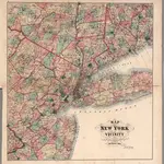 1872|Beers, J.B.1:253 440
Mapas antiguos de Trenton (Ontario)
Descubra el pasado de Trenton (Ontario) en mapas históricos
Mapas antiguos de Trenton (Ontario)
Descubra el pasado de Trenton (Ontario) en mapas históricos
En busca de un Google Maps API Alternativa?